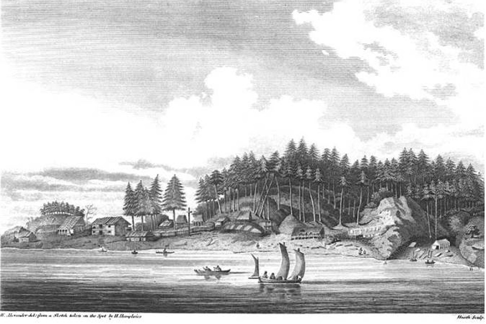
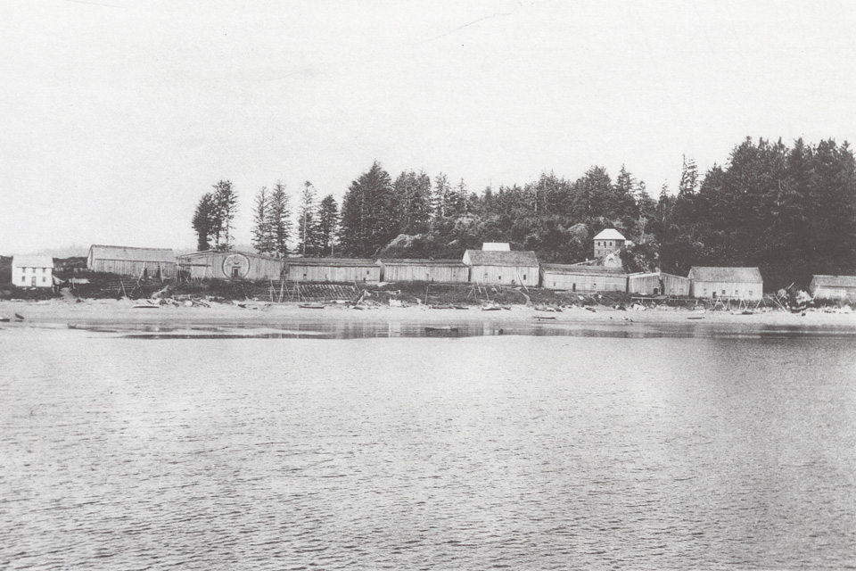
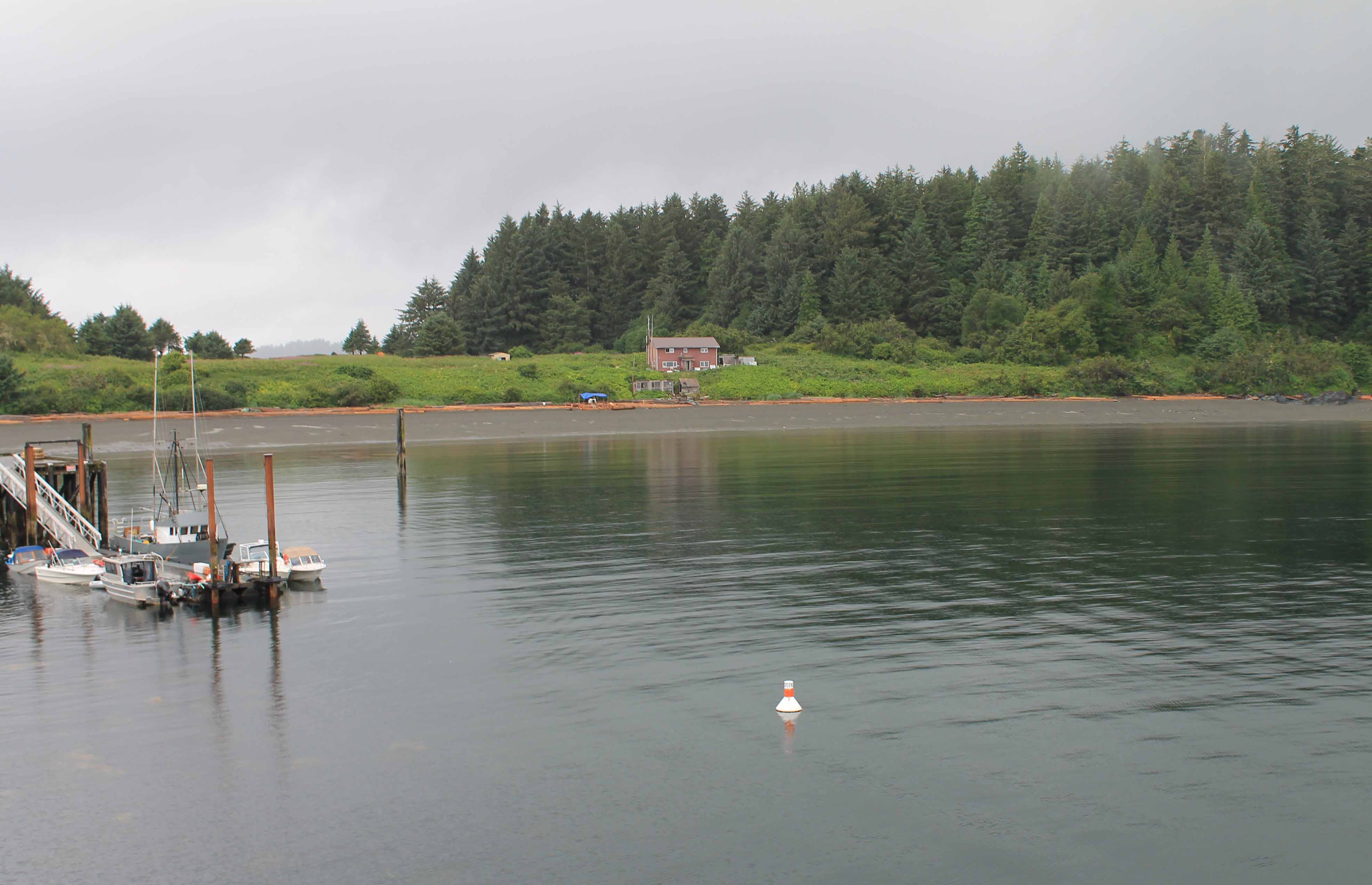
Yuquot on Friendly Cove, Nootka Sound in 1792 (sketch from the journals of Captain Vancouver), 1896 (Edgar Fleming, BC Archives), and 2012 (CW collection). The Mowachaht people would move the plank siding from the buildings and their personal possessions three times a year as part of their annual round.
1777: Captain Cook at Nootka Sound
In July of 1776, Captain James Cook, England’s famed navigator and cartographer, left England for his third great expedition to the Pacific Ocean. With the ships Resolution and Discovery Cook was in search of a famed, mythical northwest passage that would provide a seaway across America. After over a year in the Indian and Pacific oceans, and reaching the Sandwich (Hawaiian) Islands, the expedition sighted the American northwest coast at 44°33´ (near present day Newport, Oregon) on March 7, 1777. They carefully tacked northwards, often in foul weather, and failed to detect either the mouth of the Columbia River, or the Straits of San de Fuca. On March 28, by remarkable coincidence, Cook sailed into Nootka Sound, likely near where the Spaniard Juan Pérez had made a brief visit in 1774. Cook had no prior knowledge of the Spaniard’s trip, but during his visit obtained Spanish silver spoons from the local Nuu-chah-nulth peoples that confirmed the earlier visit of Pérez. 1
For the nearly a month, Cook anchored on Blythe Island while repairing his ships with the abundant wood from the coastal forest. The anchorage was immediately across the sound from the village of Yuquot that occupies what the expedition called called “Friendly Cove” due to mutually beneficial trade with the Nuu-chah-nulth. Requiring good clothing for their upcoming trip northwards, Cook’s crew traded iron and brass for about 1500 sea otter skins, or 13 skins per sailer. The trade drew native visitors from across the region, but in a pattern that would often occur in the future, the local people quickly became the “middlemen” in the transactions and often blocked direct access to the British. The incredible value of the sea otter pelts for international trade became apparent when Cook’s crew members sold them in Asian ports in 1779, sometimes for returns as high as 1800% above their initial trade value in iron or brass. 2
The “Nootka Crisis”
The early drafts, then published journals and maps of the Cook expedition would, by the mid-1780s provide the world with the first detailed descriptions of conditions on the northwest coast. Moreover, several crew members on the expedition initiated ventures to tap the sea otter market. During the next decade, isolated Nootka Sound became an international focus for trade and imperial intentions. British Captain James Hanna in the 60 ton brig Sea Otter made Nootka a port-of-call in 1785. In an unfortunate incident, perhaps triggered by an insult to Chief Maquinna, the British killed 12 Native Americans. John Meares, a veteran British naval mariner, also arrived during this early period in two ships under Portuguese flag, and he spent the summer of 1788 at Yuquot building the sloop Northwest— the first non-aboriginal vessel built on the northwest coast. In 1789 the Spanish sent a military force to Nootka to fortify Friendly Cove and block further challenges to their west coast domain. The fortification of Nootka, and subsequent Spanish seizure of British and American ships precipitated an international crisis when Britain threatened war with Spain. The issue was resolved by the 1790 “Nootka Convention” that made provision for both British and Spanish trade on the northwest coast. However, over the next few years, it would be Americans from Boston that dominate the coastal fur trade. 3
One outcome of the conflict over the northwest coast was that both the Spanish and the British sent expeditions to “show the flag” and do more detailed charting of the complex shore line. Although Cook’s expedition had largely debunked the myth of the fabled northwest passage, both countries could not ignore even the remote possibility of a waterway’s existence. The Spanish sent out expeditions in 1788 and 89 under Esteban José Martínez, with his skillful pilot José María Narváez. These voyages established Spain’s first actual contact with the Russians to the north, and following reports of American and British sea otter traders, mapped the entrance to the Juan de Fuca Strait. In 1791, Alejandro Malaspalina led the Spanish forces at Nootka, and Narváez continued exploration into Juan de Fuca channel. In 1792-93 both the British and Spanish navies arrived on the northwest coast in strength. As their differences were resolved through the Nootka Convention, crews under the leadership of Britain’s George Vancouver and Spain’s Malapalina began an interesting cooperative effort to map the interior waterway between the mainland and Vancouver Island. 4
< Previous page Chapter Outline Next page>
Map and Footnotes:
- http://en.wikipedia.org/wiki/James_Cook ; Gough, B.M. The Northwest Coast: British Navigation, Trade, and Discoveries to 1812. Vancouver: UBC Press. 1992. ISBN 0-7748-0399-1 ↩
- Gough, B.M. The Northwest Coast: British Navigation, Trade, and Discoveries to 1812. Vancouver: UBC Press. 1992. ISBN 0-7748-0399-1; Gibson, J. R. Otter Skins, Boston Ships, and China Goods: The Maritime Fur Tread of the Northwest Coast, 1785-1841. Montreal-Kingston: McGill-Queen’s University Press. 1992 ↩
- http://en.wikipedia.org/wiki/Nootka_Crisis ; Gibson, Otter Skins ↩
- Cutter, D.C. Malaspalina and Galiano: Spanish Voyages to the Northwest Coast 1791 & 1792. Vancouver: Douglas and McIntyre, 1991 ; Gough, The Northwest Coast ↩


