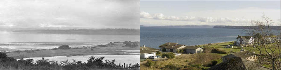
Lincoln Beach, Port Townsend looking east towards Marrowstone Point in 1921 (George Welch) and Ann Welch (2006). Both images are part of collection of Port Townsend repeat photographs available at http://porttownsendthenandnow.com/ George Vancouver’s expedition charted this section of the coastline on May, 1792.
May and June, 1792: George Vancouver Maps Puget Sound
While mapping the entrance to what is now Puget Sound the English observed several lines of tall posts erected by the local Clallam peoples. At today’s Marrowstone Point, east of a bay they named Port Townsend, Vancouver, mystified at their purpose, described that:
These poles had frequently presented themselves, though in less numbers than on the present occasion; but though these afforded us an opportunity of examining them, they did not contribute the lead instruction concerning the purpose for which they were intended. They were uniformly placed in the center of the low sandy spit, at the distance of about eighty yards from each other and it should seem, that thev were required to be of certain definite heights, although not all equally high…. Between several of them large holes were dug in the ground, in which were many stones that had been burnt…” 1
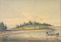
Tall posts at Marrowstone Point near Port Townsend, May, 1792 (William Alexander watercolour from a sketch made by J. Sykes, Newberry Library Collection).
Later European visitors would learn that these posts were used by the S’Clallam people, living along the south shore of the Straits of Juan de Fuca, to hold netting that would trap birds attracted at night to fires burning in the pits between them. 2 Since Vancouver’s time, the community of Port Townsend has developed on the western shore of the bay, and the adjacent were fortified by the United States government for defense of Puget Sound.
<Previous page Chapter Overview Next page>
Map and Footnotes: