

During the spring of 2003 Parks Canada began ignition of the massive Fairholme Range prescribed fire (lower to mid right side of the photograph), an expanse of over 20 square kilometers up-valley from the cleared fuel break zone. The burn’s objective was to restore meadows, younger more healthy pine forests, and important montane wildlife habitats in the lower Bow Valley.1
The fuelbreak, in combination with snow on the mountain peaks, was essential to hold hold early season prescribed burns that widened out the containment area. Planners insisted that the fuelbreak and adjacent early season burns might be necessary to hold the major planned burn planned for warm dry conditions later in the fire season.
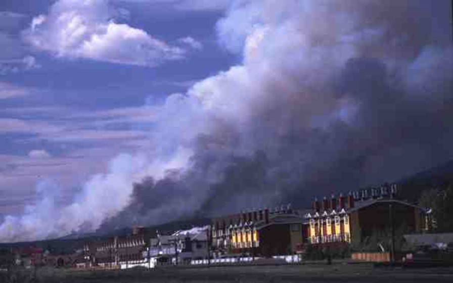
View from the Town of Canmore of an early season prescribed fire (May 28, 2003) in and adjacent to the Carrot Creek fuelbreak. Although the smoke looks ominous, relatively wet spring conditions dampened fire activity, and the fuelbreak itself was completely burned out and extinguished that evening.
Ultimately, the Carrot Creek fuel break and adjacent spring burns were critical to hold the main blaze within its prescribed boundaries during the increasingly dry conditions of August, 2003 when wildfires spread across the Alberta and BC mountains. The Alberta government has also cleared fuel breaks on the opposite side of the valley below Mount Rundle. These clearings and the Fairholme prescribed fire are a good example of an integrated approach to providing fire protection for the Town of Canmore, a town of over 15,000 inhabitants just down valley from Banff’s border, while at the same time restoring the park’s fire dependent ecosystem.2
Footnotes and Map
- White, C. A., T. E. Hurd, M. Hebblewhite, and I. R. Pengelly. “Mitigating Fire Suppression, Highway, and Habitat Fragmentation Effects in the Banff Bow Valley Ecosystem: Preliminary Results of a Before-After-Control-Impact (BACI) Design with Path Analysis.” In Monitoring the Effectiveness of Biological Conservation, edited by J. Innes and J. Timko. Vancouver: Forrex, 2007; White, C. A. and W. Fisher. “Ecological Restoration in the Canadian Rocky Mountains: Developing and Implementing the 1997 Banff National Park Management Plan.” Pages 212-242 in: M. Price, editor. Mountain Area Research and Management: Integrated Approaches. Earthscan, London, 2007. ↩
- Wakinshaw, S. Town of Canmore: FireSmart Mitigation Strategy. Canmore: Montane Forest Management Ltd., 2010; White, C. A., D. D. B. Perrakis, V. G. Kafka, and T. Ennis. “Burning at the Edge: Integrating Biophysical and Eco-Cultural Fire Processes in Canada’s Parks and Protected Areas.” Fire Ecology 7 (2011): 74-106. ↩