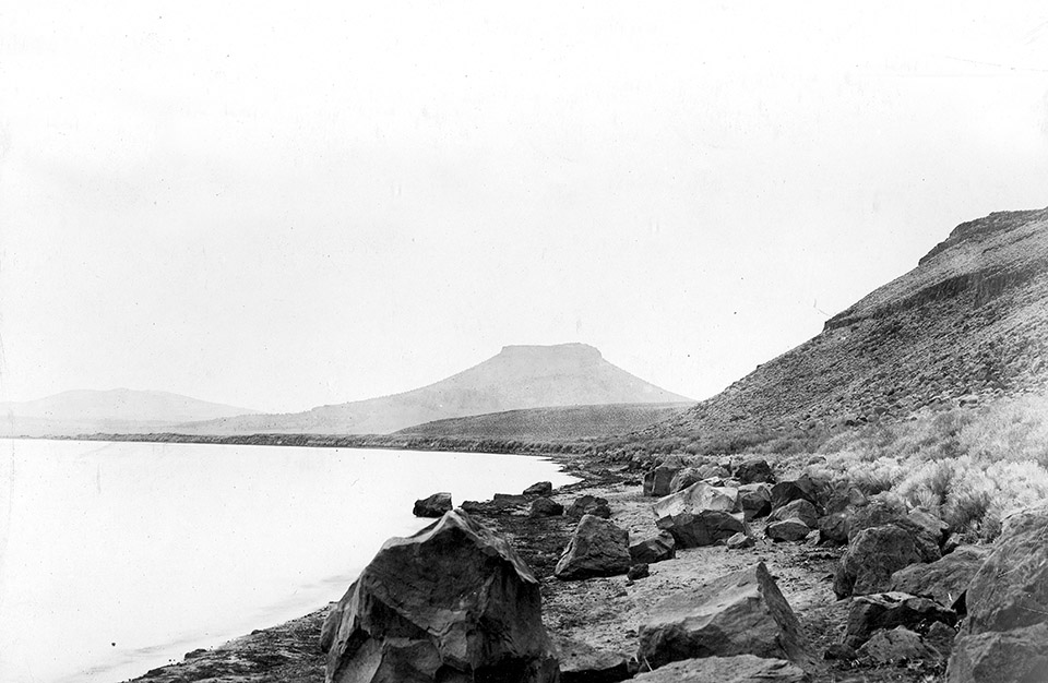
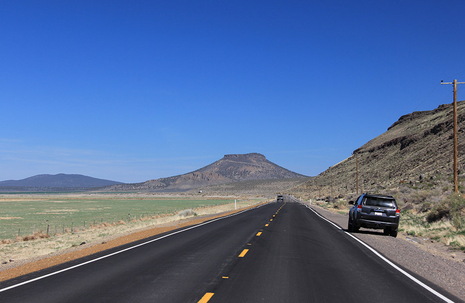
Silver Lake and Table Top Mountain in 1904 (USGS-mwc00564) and a similar view from Oregon Highway 31 in April 2016 (CW-2016-04-19-0969). The historic photograph shows Silver Lake at nearly its highest recorded level. Its level likely varied widely in prehistoric times, and for the past century, hydrologists describe that:
Silver Lake, in the Fort Rock basin, is fed mostly by Silver Creek and other streams that enter by way of Paulina Marsh. Overflow last occurred in 1905, and use of water for irrigation has decreased the likelihood of future overflow. The lake apparently loses water to unsaturated zones beneath its bed. Silver Lake was dry from 1922 to 1950, refilled to its highest recent level in 1958, and became dry again in August 1961. 1
Climate and Bison Distribution in Oregon
The long-term fluctuation of water levels and other influences of climate change are clearly a potential influence on periodic western movements of bison. But this presents a dilemma for why bison occurred in some locations and not in others. For example, archaeologist Donald Grayson remarked on the situation for the Fort Rock Basin surrounding Silver Lake:
The appearance of bison in south-central Oregon after 500 14C yr BP may be a function of the increased winter moisture and cooler temperatures that marked this region during the ‘Little Ice Age’, which began about 350 14C yr BP….. No matter what the cause of this increase, however, it is not clear why Holocene-aged bison remains are nearly absent from the far northwestern corner of the Great Basin… In spite of intensive archaeological work here during the past two decades…, only a single late-Holocene record for bison is available from this region ……This is especially perplexing since there are no obvious biogeographic barriers to prevent the movement of bison between the Malheur and Harney basins, on the one hand, and the Fort Rock Basin on the other. There is also no reason to think that climatic change that impacted the Malheur and Harney basins would not have impacted the adjacent northwestern corner of the Great Basin as well. 2
One explanation that reconciles this difficulty in understanding spatial variation is to recognize that bison abundance is influenced by both “bottom up” processes (grass production, water availability etc.) that influence bison productivity, and “top-down” factors such as human predation that influence bison mortality. At the western edge of the range, these two groups of factors would closely interact. For example, during drought periods, not only would declining grass productivity reduce regional bison birth rates (a bottom-up effect), but low numbers of bison on the west edge of their range might be more concentrated on the remaining productive wetland sites, or at water sources, and be easier to hunt (a top-down effect). Thus, western dispersal would be sharply limited at these times, although source bison populations further east might still be productive.3
Map and Notes
- Phillips, Kenneth N. and A. S. Van Denburgh, Hydrology and Geochemistry of Abert, Summer, and Goose Lakes, and Other Closed-basin Lakes in South-central Oregon. United States Geological Survey Professional Paper 502-B. Washington, DC. ↩
- Grayson, D. K. “Holocene Bison in the Great Basin, Western USA” The Holocene September 2006 vol. 16 no. 6 913-925 ↩
- Van Vuren, Dirk. “Bison West of the Rocky Mountains: An Alternative Explanation.” Northwest Science 61 (1987): 65-69; for a more theoretical discussion see Caughley, G., D Grice, R. Barker, and B. Brown, “Edge of the Range”, Journal of Animal Ecology 57 (1988): 771-785. ↩

