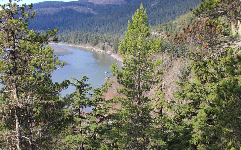
In the last century, this bend along the delta of the Nass River has meandered over 100 meters to “river’s right”, eroding away much of the native fishing village visible in the historic photograph. In fact, highway engineers have placed several hundred meters of rip-rap boulders to protect the modern highway (obscured by trees) that now parallels the river. Haldane’s historic photograph shows numerous native peoples gathered for the traditional spring oolichan fishery. This harvest continues to the present day, with boats and camps visible along the river bank. Oolichan processing requires abundant firewood to process the grease. Wood cutting and fires running upslope from the camps maintained the young forests visible in the old photograph. Current land managers suppress fires to grow forests for timber harvest, with cutblocks visible in the upper section of the modern photograph. Lodgepole (shore) pine, regenerated by the historic fires, obscures the view in the recent photograph. Modern-day oolichan camps use propane burners and wood brought in by boat.1
Footnotes and Map
- An excellent series of historic photographs showing the process of making grease is provided in the book: Savard, D. Images from the Likeness House. Victoria, BC: Royal BC Museum, 2010; The historic development of oolichan harvesting at Fishery Bay is described by: http://royalbcmuseum.bc.ca/exhibits/living-landscapes/northwest/oolichan_history/fishery_bay.htm ↩

