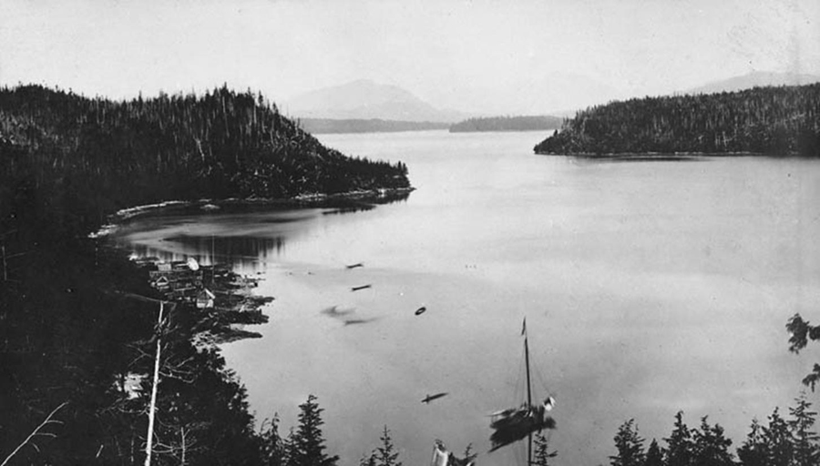
Bella-Bella, 1874 (Charles Horetzy , Public Archives Canada PA-020537). A repeat photograph is required.
1792 and 1793: George Vancouver Maps Coast near Bella Coola
During Vancouver’s 1792 mapping expedition, his ships did preliminary mapping of the interior channels of the west coast as far north as the present location of Bella Bella. For August 16, Archibald Menzies recorded that he was working on a longboat doing preliminary explorations of the Labourchere Channel:
We proceeded up the North East Arm assisted by a favorable breeze between two high ridges of dreary rocky mountains whose steep sides were thinly coverd with stinted woods while their summits were capt with perpetual Snow…. in a Bay nearly opposite to it we observd some Smoak near the Beach which indued us to land in expectation of seeing some of the Indians, but we found only an old deserted Hut that had been so lately occupied that the remains of the Fire was still burning by it, & behind it we found a large Canoe of 42 feet long hauld up into the Woods to be repaird. 1
Short on provisions, they concluded the charting for that year at what is now called Point Menzies at the junction of North and South Benthink arms, and then proceeded southwards to Nootka, then the mouth of the Columbia River, before wintering in Hawaii. In 1793, Vancouver’s ships returned to Fitzhugh Sound on May 26. During latter May and early June, they used longboats to further map the complex channels of the area. On June 3, 1793 they completed the mapping of South Benthink Arm that had begun the year before. Only a few weeks later, on July 22, North West Company fur trader Alexander Mackenzie would canoe the waters of this inlet after travelling overland from Montreal, completing the first land crossing of North America.
With good access to the interior via several “grease trails” over the Coast Range, the interior channels around Bella Bella, the homelands of the Heilsuk people, would continue to be important for the fur trade. In 1833 the Hudson’s Bay Company established Fort McLoughlin on a sheltered bay on Campbell Island (see above photograph). A large village the Heilsuk called ’Qélc was located here, but Europeans recorded various other names for it, perhaps derived from the local geographical name Pélbála, that eventually gave rise to the modern English name Bella Bella. The HBC trading post closed in 1843, but the anchorage eventually became a small port and general store in the 1860s. 2
<Previous page Chapter Outline Next page>
Map and Footnotes