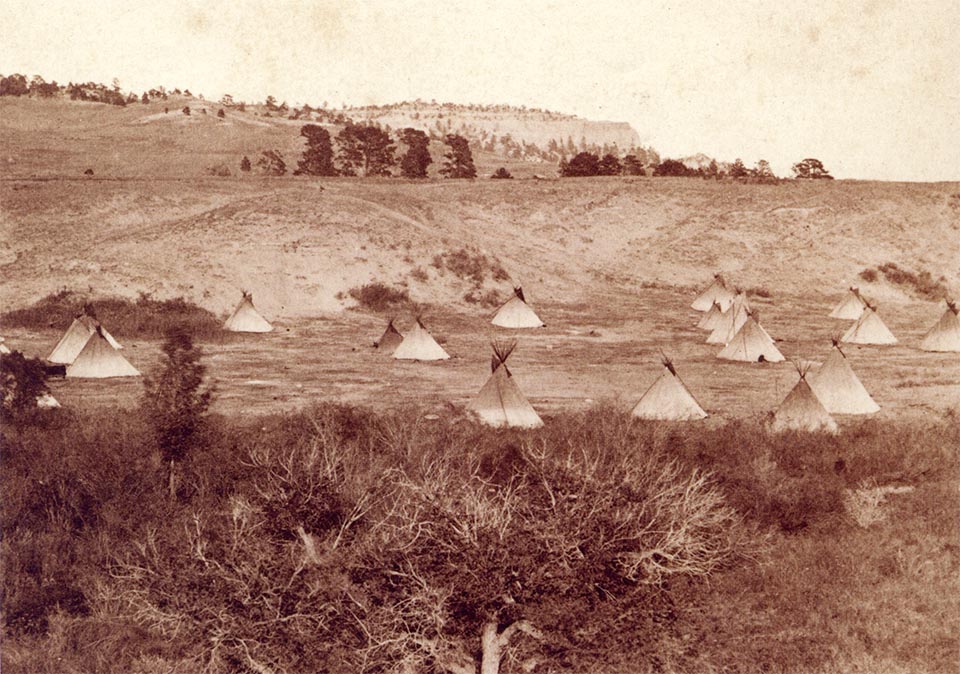
An Arapaho village west of Red Cloud Agency at Camp Robinson in c. 1875 (Buckley Collection 6-4) and in 2018 (CW-2018-05-11-0970). This meadow lies on the headwaters of the White River about 8 miles west of Camp Robinson. Since the 1870s the riparian zone has been altered by construction of a railroad, and a subsequent flood that swept away the bridges, and much of the fill placed during the construction. The Arapaho were camped here to obtain supplies provided by the US government at the Red Cloud Agency of the Bureau of Indian Affairs, located at Camp Robinson. The historic photographs were collected Peter J. Buckley who worked at the agency during this period, and are published in a book that provides an excellent history of the period by Thomas R. Bueckner, long-time curator for the Fort Robinson Museum.1
Footnotes and Map
- Buecker, Thomas R. Last Days of the Red Cloud Agency: Peter T. Buckley’s Photograph Collection 1876-1877. Lincoln: Nebraska State Historical Society, 2016. ↩

