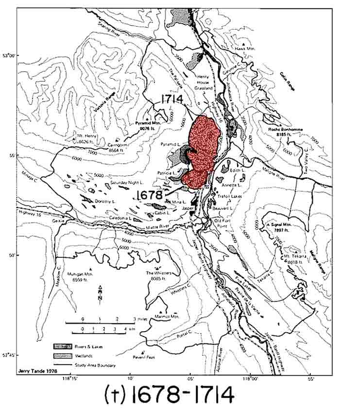
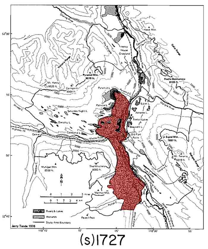
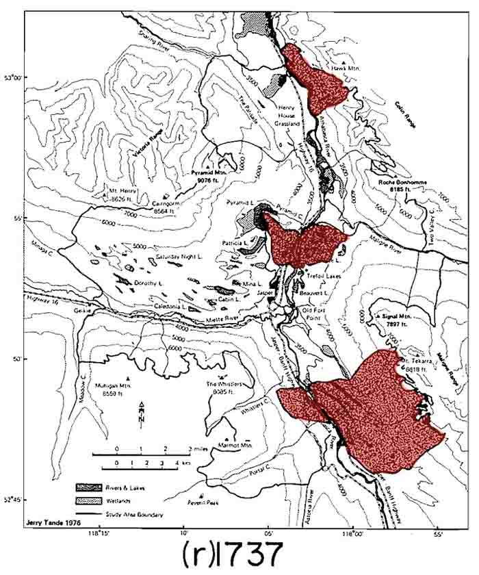
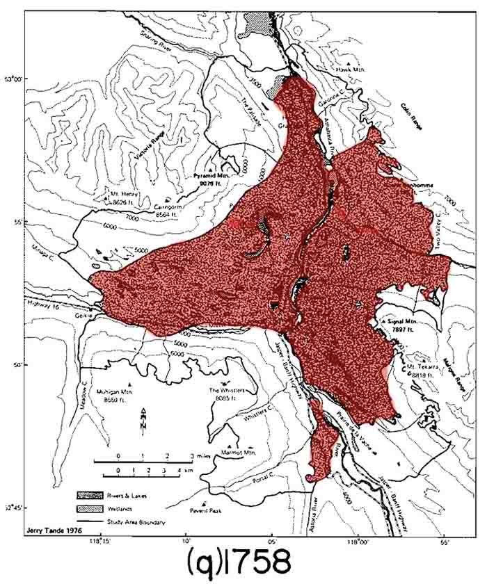
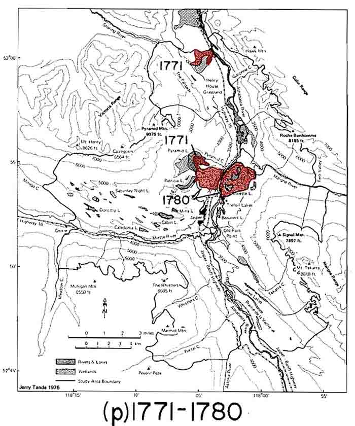
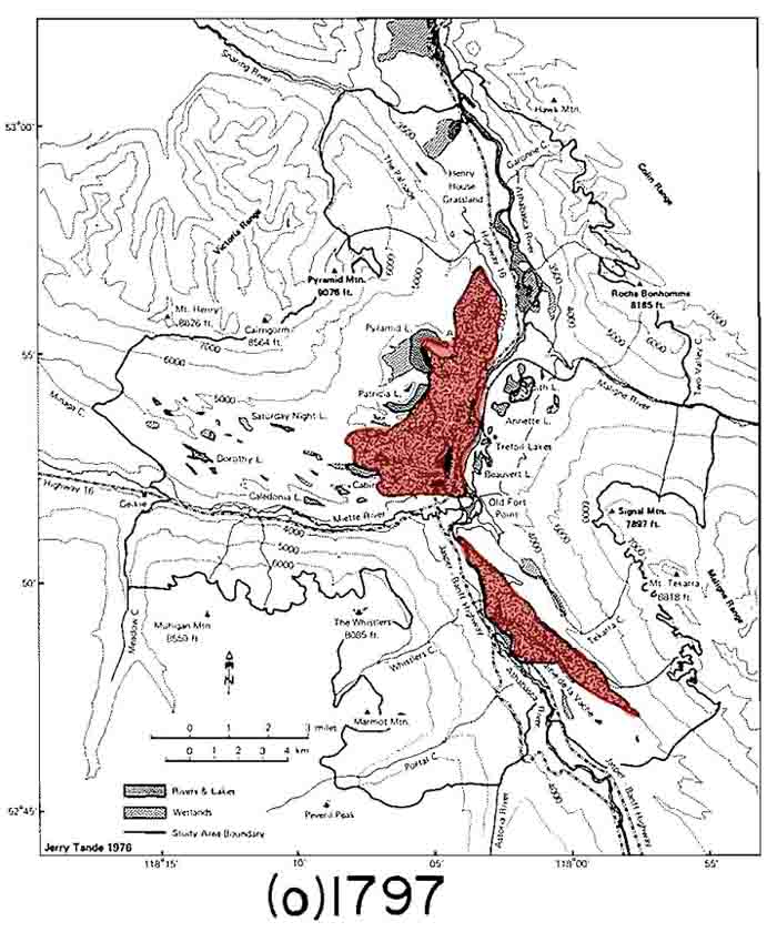
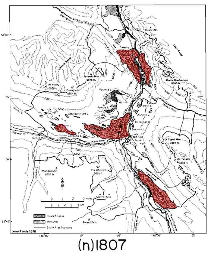
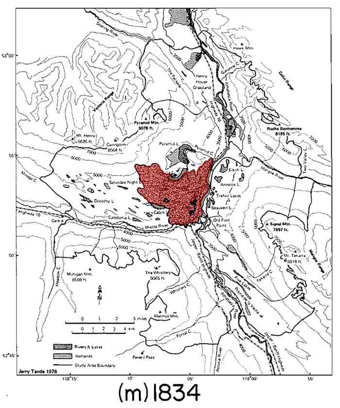
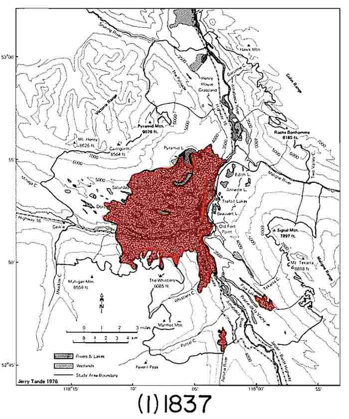
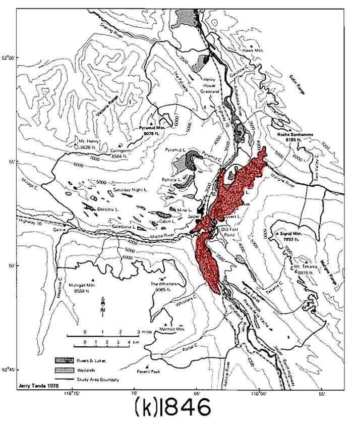
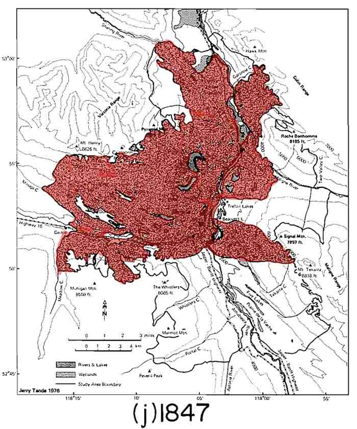
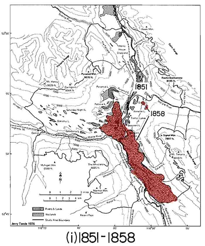
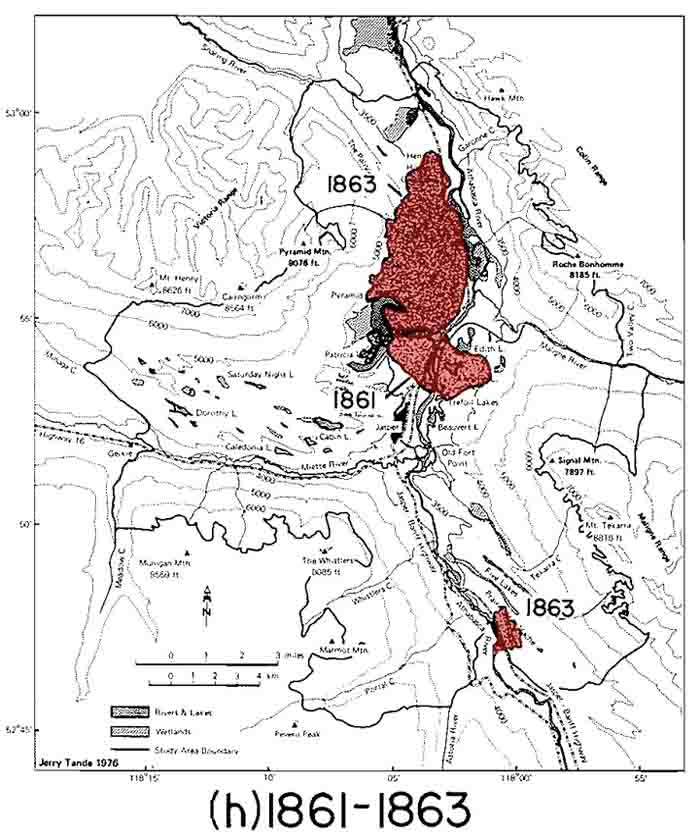
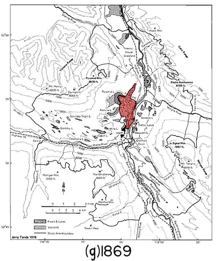
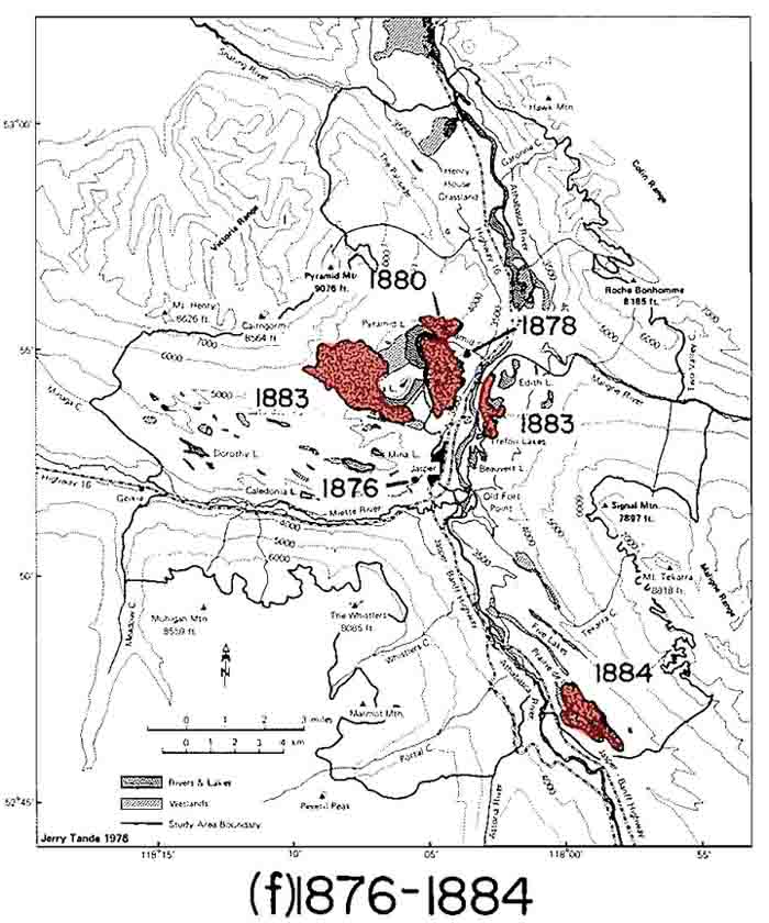
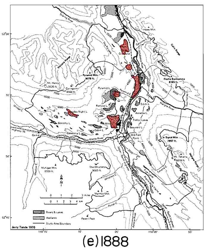
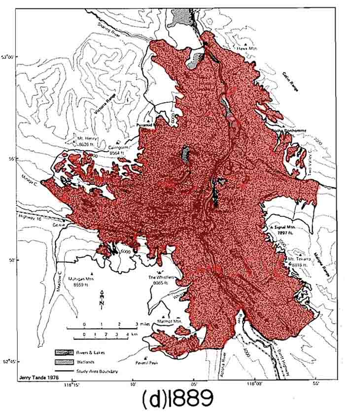
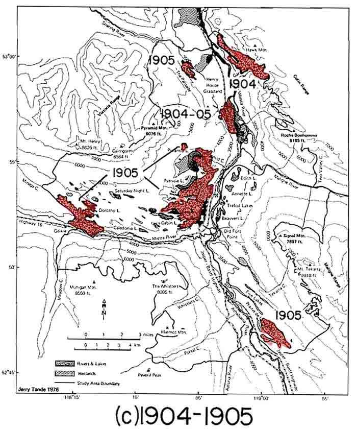
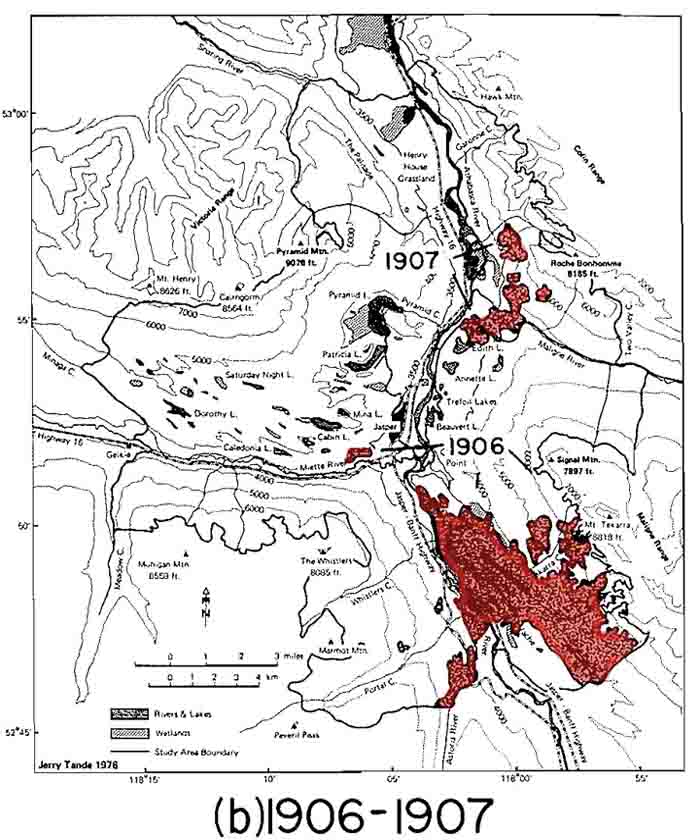
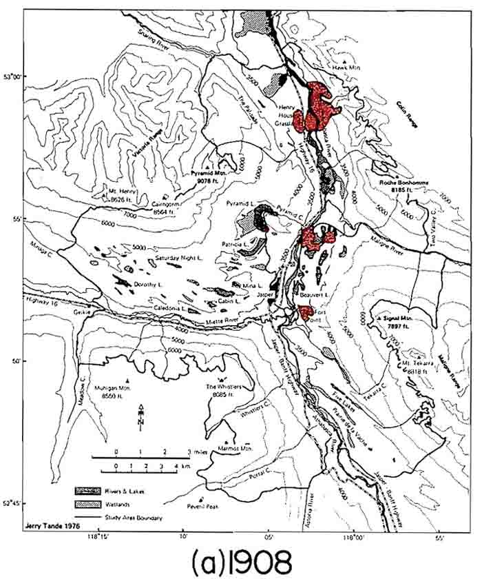
Ecologist Gerald Tande took wedges and disks from hundreds of trees to develop the following set of maps that approximate burning patterns in the Athabasca Valley around Jasper townsite. 1 These maps and their amazing dataset of tree age and fire-scar observations have helped inform a series of recent studies of landscape change and detailed fire history near Jasper. 2 More then/now images of vegetation change near Jasper are available here.
Source: Tande, G. F. “Fire History and Vegetation Pattern of Coniferous Forests in Jasper National Park, Alberta.” Canadian Journal of Botany 57 (1979): 1912–1931.Map and Footnotes
- Tande, G. F. “Fire History and Vegetation Pattern of Coniferous Forests in Jasper National Park, Alberta.” Canadian Journal of Botany 57 (1979): 1912–1931. ↩
- For example see: Rhemtulla, J. M., R. J. Hall, E. S. Higgs, and S. E. Macdonald. “Eighty Years of Change: Vegetation in the Montane Ecoregion of Jasper National Park, Alberta, Canada.” Canadian Journal of Forest Research 32 (1999): 2010–2021; Chavardès, R. D., and L. D. Daniels. “Altered Mixed-severity Fire Regime has Homogenized Montane Forests of Jasper National Park.” International Journal of Wildland Fire 25-4 (2016), 433–444. ↩
