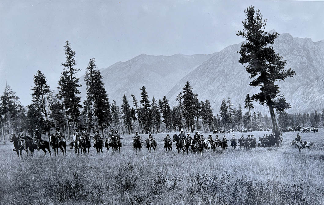
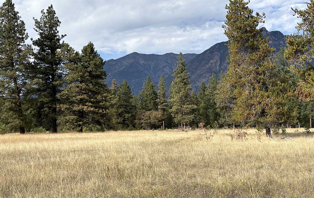
Northwest Mounted Police 1888 (BC Archives C-05518) , and meadows and forest in Norbury Lake Provincial Park in October, 2026 (CW-Iphone-7610).
This has been one of my more difficult retake dilemmas. I always thought that when the Sam Steele’s troop finished their posting at Fort Steele in 1888 that they went back north (the way they arrived in 1887). Actually, on leaving they went south and around through Crowsnest Pass to Fort Macleod. Naomi Miller’s excellent book tells the story of both trips. The historic photo likely records the outfit right after it was all packed up and was in order for proceeding south to their first night’s camp at Bull River. Likely Steele had his constables first move all gear for transport south from town by wagon to this assembly point.
The ecology here is interesting. First of all, I’m still out a few tens of meters or so from the actual historic photopoint– check the ridge on the horizon for reference. Then there’s the issue of the leaning trees. It looks like all species (ponderosa pine, lodgepole pine, Douglas-fir) lean to the north, especially in the historic photograph, but also some still do today. What’s this all about? These open forests were likely being burned on <5 year cycle right up until the 1970s, and usually in late March or early April just as the snow was melting. Parks Canada wardens joined landowners and BC government staff on some of these burns. Was the classic Indigenous and early settler firing prescription a warm dry south wind that might result scarring on the north side of trees, and growth with a tilt to the north?
References
Miller, Naomi. 2019. Fort Steel: Gold Rush to Boom Town. Wildhorse Press.