Summer 1792: Spain and England Chart the Inside Channel

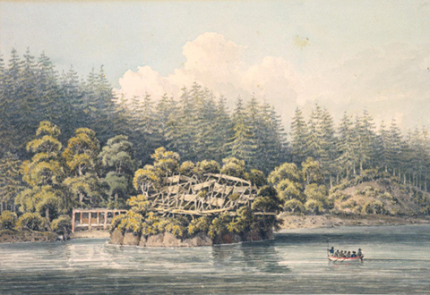
First Nations’ village, Homfray Channel, June, 1792 (William Alexander watercolour from a sketch made by J. Sykes, Newberry Library Collection).
On June 24, 1792, the mapping expeditions of the English, commanded by Vancouver, and the Spanish, led by Galiano and Valdes, moved northwards into Desolation Sound. For the next few weeks the two countries cooperated to jointly chart the complex fjords and channels between the north end of Vancouver Island and the mainland. Their journals describe awesome scenery, abundant resources from the sea, and visits to several native villages. On June 27, Menzies described a village, then temporarily vacant of local residents, likely Sliammon (Tla’amin) peoples, placed on top of a small rock buttress in a bay on Homfray Channel:
This Rock was inaccessible on every side except a narrow pass from the Land by means of steps that admitted only one person to ascend at a time & which seemed to be well guarded in case of an attack, for right over it a large Maple Tree diffuse its spreading branches in such an advantageous manner as to afford an easy & ready access from the summit of the Rock to a concealed place amongst its branches, where a small party could watch unobserved & defend the Pass with great ease. We found the top of the Rock nearly level & wholly occupied with the skeletons of Houses—irregularly arranged & very crowded; in some places the space was enlarged by strong scaffolds projecting over the Rock & supporting Houses apparently well secured. These also acted as a defence by increasing the natural strength of the place & rendering it still more secure & inaccessible. 1
While visiting the village, Menzies and his companions were covered with swarms of body fleas. They made a hasty retreat, spending the rest of the day swimming, dragging their clothes behind the boat, and ultimately boiling their clothes. The surgeon learned a valuable lesson on one of the reasons the villages were periodically abandoned:
From what we saw & experienced the few minutes we were in this Village we have no doubt but these troublesome guests have obliged its late Inhabitants to quit it & remove to some fresh situation, & this will in some measure account for the number of deserted villages we have observed in our different excursions through this Country. 2
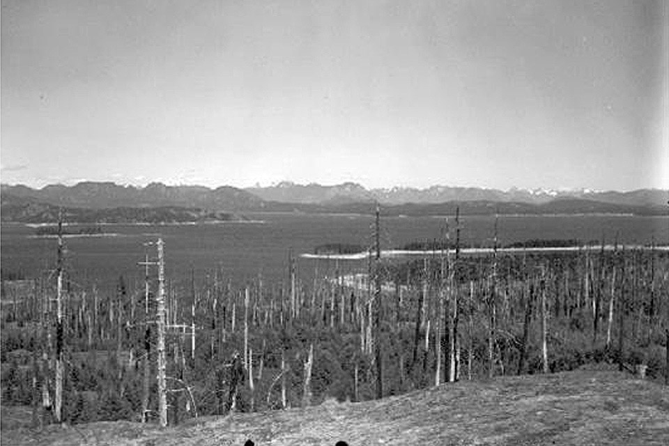
On July 13, Captain Vancouver met with the Spaniards who had been charting northwestwards up Bute and Toba inlets (channels in the background left of the photographs). The two expeditions shared their charting progress to-date. Valdes and Galiano planned to continue detailed surveys in the complex inlets to the northeast, whereas the British planned to move northwards more rapidly, using a waterway (Johnson’s Strait) that the tidal patterns indicated provided a direct route to the sea. Vancouver departed from the Spaniards on good terms, and they promised him a pleasant welcome at Nootka when the English made their planned stop later in the summer. Galiano and Valdes would complete the first direct circumnavigation of Vancouver Island upon their arrival at Nootka on August 31, 1792. 3
<Previous page Fur Trade Chapter Outline Next page>
Map and Footnotes:
- Newcombe, C. F. (ed.) Menzies’ Journal of Vancouver’s Voyage. Victoria, BC: Cullin, 1923, 66-67 ↩
- Newcombe, Menzies’ Journal: 67 ↩
- Vancouver, George. A Voyage of Discovery to the North Pacific Ocean and Round the World, 1798. London: Robinson and Edwards. Volume 1: 335; Cutter, D. C. Malaspina and Galiano: Spanish Voyages to the Northwest Coast 1791 and 1792. Vancouver: Douglas and McIntyre, 1991: 127 ↩

