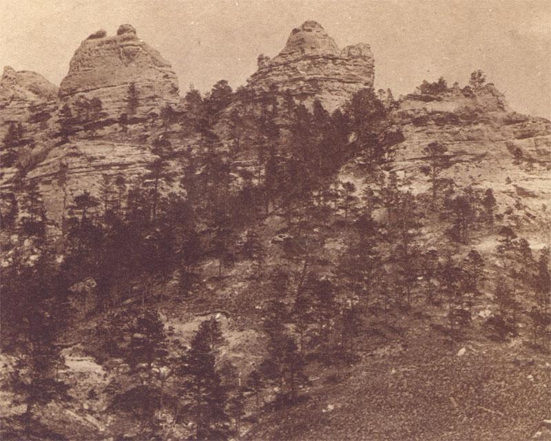
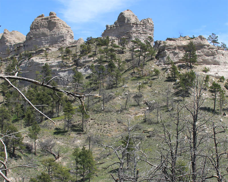
Crow Buttes, south of the White River in c. 1875 (W. C. Thomas, Nebraska State Historical Society), and in 2018 (CW-2018-05-11-0951). Thomas’ image was included in Mitchel’s 1876 published series Stereoscopic View of the Black Hills Gold Region and the Cheyenne Route to the Eldorado. The historical image is in a book by Thomas R. Bueckner, long-time curator for the Fort Robinson Museum. that provides an excellent history of the area near Fort Robinson and the Red Cloud Agency 1
The treed slopes of the buttes may have provided shelter for herds of buffalo that frequented this area up until the 1860s. Note the eroded scoops under the trees in the lower part of the historical view. These occur when bison paw the soil while seeking shade in the summer, or shelter in the winter. Today, bison make similar diggings in the display pasture near Fort Robinson. The north facing slope of Crow Buttes likely held snow patches later in the spring season, thus was burned less often than nearby lands. The recent view has numerous dead trees that were killed by fire in c. 2000.
Footnotes and Map
- Buecker, Thomas R. Last Days of the Red Cloud Agency: Peter T. Buckley’s Photograph Collection 1876-1877. Lincoln: Nebraska State Historical Society, 2016. ↩

