Please click on link to see another repeat photograph series for Ross’ Hole, describing Native American, Lewis and Clark’s and early fur trader’s visits here in relation to the area’s ecology.
Fire Suppression Effects on Fine Scale Fire Frequency and Severity
Early white settlers could not know how their activities would alter a complex, fine scale fire regime that had existed for millennia of Native American use. Ross Hole on the upper Bitterroot River was a traditional camping ground for Flatheads, Nez Perce, and other tribes crossing over the mountains to hunt bison on the plains to the east. In 1883, Herbert “Berte” Lord, then aged 12, settled with his family in the upper Bitterroot Valley. He recounted that in 1885:
“we went to Ross Hole, there was an old abandoned cabin that stood near where Jake Wetzsteon now lives and we moved into that. This was the only cabin in Ross Hole at that time… My father and I went to work putting up hay. He hired a McCormick Machine and Rake from W.B. Harlan at Como paying $1.00 per day for the use of them. Then we hayed all over Ross Hole wherever we could find a piece of grass that was worth cutting and hauled it home on a wagon. There was no one else living in Ross Hole at that time so the country wide open and no line fences to bother. When we got through haying, we estimated we had about 40 tons of hay and we about horses enough to eat it, but we had no cattle. This was the first hay ever put up in Ross Hole….
In those days the Indians came up there for a couple of big hunts each year, one in the spring and the other in the fall. When they abandoned a camp where they had been hunting, they always hung up the ears and the feet of any game had killed. While in that camp, the Indians unlike the Whites never wasted game they killed. They killed what they needed and no more….
Well the winter of 1886-7 was one that anyone that was living in the northwest will remember as long as they live. It either snowed or rained 57 days out of 68 and that was the time that Charlie Russell painted his famous picture, “The Last of the 5000.” There was four feet of solid snow on the ground and in the later part of the winter and spring it was crusted so hard that the elk and moose could walk all over it. 2
Clearly, these early settlers, bound to their homesteads, would have had a much different attitude wildland fire than native Americans. Fires could destroy their cabins and fences. A late summer fire could consume the supply of hay so badly needed to winter domestic horses and cattle in mountain valleys. Unlike more nomadic Flatheads, they could not simply move on to an unburned portion of the valley.
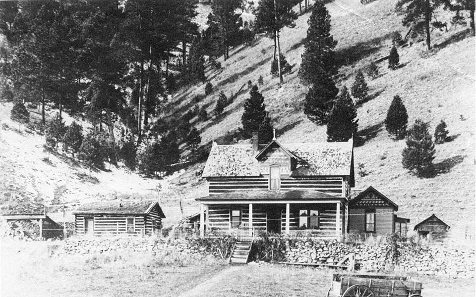
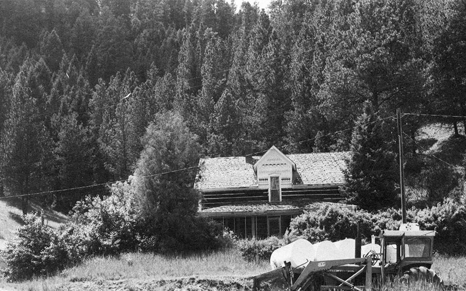
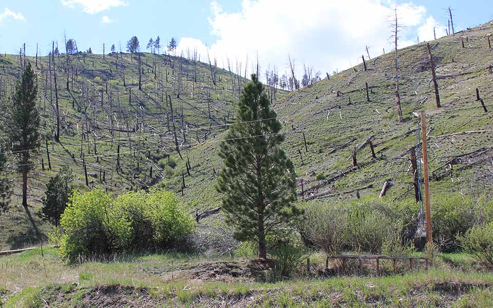
The series of photographs show long-term effects of replacing the long-term native American fire regime with more recent policies of fire suppression. In the 1890s, the hillside behind the cabins still shows the fine-scale effects of frequent, low intensity fires. On the western facing slope (right side of photographs), fire was likely most frequent due to drier conditions–perhaps almost annual burning occurred– and this removed most ponderosa pine seedlings before they could reach heights less susceptible to fire mortality. Immediately to the west, on the cooler east-facing slopes on the left side of the photograph, fire was less frequent, allowing regeneration and growth of a denser, but still relatively open stand of ponderosa pine. 3 The close proximity of these two different types of fire is likely evidence that many fires occurred during relatively moist conditions when the right side of the photograph would burn, but the left side would not. These burns would likely then been outside the lightning season, and would occur in spring right after snow melt, or during a dry period late in the fall. Fires lit during these periods by native Americans in the grasslands of Ross Hole would, with a southwest wind common on dry days, easily spread to this slope.
Frequent burning ceased in the late 1800s with removal of native Americans to reserve lands, settlement by early ranchers, and establishment the Forest Service in the early 1900s. George Gruell’s 1980 photograph shows several decades of fire-free forest growth. The development of a homogenous dense forest across all aspects and elevations created conditions favorable for large, high severity fires. During the dry summer of 2000 massive wildfires swept through the Bitterroots. High intensity fire scorched both aspects of the slope, killing the majority of trees. Fortunately, the historic homestead cabin was moved to another location in the 1990s, and was not damaged by the fires.
Map and Footnotes
- Gruell, G. E. Fire and Vegetative Trends in the Northern Rockies: Interpretations from 1871–1982 Photographs. USDA Forest Service General Technical Report INT-158. Ogden, UT: Intermountain Forest and Range Experiment Station, 1983. ↩
- Backus, Perry. 2011 as reported in the Ravalli Republic. http://ravallirepublic.com/lifestyles/blife/article_2814486c-5fff-11e0-a1cb-001cc4c002e0.html ↩
- Gruell, 1983, Fire and Vegetative Trends, p. 19. ↩


