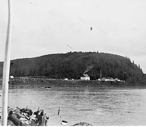
Hudson Bay Company’s Fort McMurray trading post at the confluence of the Clearwater and Athabasca River in the 1930s (University of Alberta Archives) and from a similar view point in 1990 (Gord McKenna, Flickr). A more exactly located repeat photograph is required.
1778: Peter Pond Winters on the Athabasca River
One of the interesting results of the fur trade with First Nations is that the first European mappers to cross the continent did not follow a relatively direct line from Hudson’s Bay to the Pacific Ocean. Rather, the first crossing efforts followed the route of best returns from furs, and deviated initially to the Arctic Ocean at the mouth of the Mackenzie River in 1789. The ultimate first European crossing route in 1793 traversed through fur-rich lands to Bella Coola, what is today an obscure, deep fjord into Pacific Ocean, but was long an important trade route for First Nations. 1
The fur-trading Montreal pedlars on the North Saskatchewan River recognized the high value of furs brought in by First Nations from the north of the river. In 1778, Peter Pond, a wide-travelled trader born in Connecticut, formed a partnership with several Montreal traders at Fort Sturgeon, a post on the North Saskatchewan River east of Fort Carlton. That fall, following a well-used native travel route, his expedition of 5 canoes and 25 men crossed the Methy Portage, and descended the Clearwater to the Athabasca River, the eventual site of Fort McMurray. Pond wintered some forty miles south of Lake Athabasca, and exchanging about 9000 lbs of trade goods (pots, knives, muskets etc.) with Chipewyan for 8400 beaver pelts, for an extraordinary profit once these were returned to Montreal 2

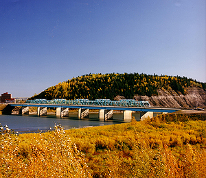
Aerial view of the downtown area of Fort McMurray from the east in the 1948 (Glenbow Museum) and in 2012 (Holger Spaedke, CW Archives).
On Pond’s trip north he, like many traders after him would certainly noticed the outcropping of oilsands along the Athabasca River north of the Clearwater’s confluence. Alexander Mackenzie paddled this stretch of river in 1780s and 1790s, and recorded:
At about twenty-four miles from the Fork are some bituminous fountains, into which a pole twenty feet in length may be plunged without the least resistance. The bitumen is in a fluid state and when mixed with gum, or the resinous substance collected from the spruce fir, and is used in gumming canoes. When heated, it emits a smell, like that of sea coal. 3
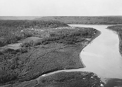
The Athabasca Oilsands are now fuelling development of one of the world’s largest industrial sites. Fort McMurray, once the location for small Northwest and Hudson Bay Company’s trading outposts (see repeat photographs) is now a city of a 77,000, and the city and region are forecasted double in population to about 240,000 by the year 2030. 4 Ultimately, greater than 100,000 square kilometers of the boreal ecoregion in Alberta, and nearby Saskatchewan may be influenced by bitumen extraction. Ecological effects include intense terrain and hydrological disturbance where bitumen is surface-mined (602 square km in 2009), to extensive road and pipeline systems where it is obtained by underground steam extraction. All mining, extraction, and processing activities require water utilization, and result in stack emissions that frequently precipitate out locally, increasing pollution in water courses. Currently, the tailings ponds resulting from oilsand’s surface mine processing are the world’s largest earth-bermed lakes (130 square km in 2009). A breach of one of these lakes could contaminate the Athabasca and Mackenzie watersheds including the Peace-Athabasca wetlands about 100 kilometers downstream, the world’s largest freshwater delta. 5
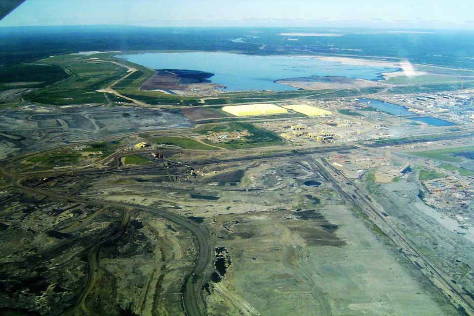
Syncrude’s Mildred Lake Plant near Fort McMurray, Alberta
<Previous page Chapter Overview Next page>
Map and Footnotes
- Mackenzie, Alexander. The Journals of Alexander Mackenzie: Exploring Across Canada in 1789 and 1793. Santa Barbara, CA: Narrative Press. 2001 ↩
- Parker, James M. Emporium of the North: Fort Chipewyan and the Fur Trade to 1835. Regina, SK : Alberta Culture and Multiculturalism/Canadian Plains Research Centre. 8-11 ↩
- Mackenzie, Alexander. The Journals of Alexander Mackenzie: Exploring Across Canada in 1789 and 1793. Santa Barbara, CA: Narrative Press, 73-74. (Originally published in 1801) ↩
- The history of fur trading posts near or close to Fort McMurray is described by: Chalmers, John W. Editor. The Land of Peter Pond. Edmonton: Canadian Circumpolar Institute Occasional Paper 12. 66-69; Population statistics are provided by: http://www.woodbuffalo.ab.ca/Doing-Business/Municipal-Development-Plan.htm (Accessed 30/12/2013) ↩
- References for oilsands development effects include: Government of Alberta. Environmental Management of Alberta’s Oilsands: Resourceful, Responsible. Edmonton: Alberta Environment. 2009: Website: http://environment.gov.ab.ca/info/library/8042.pdf Accessed 30/12/2013; Kelly, E.N.; Short, J.W.; Schindler, D.W.; Hodson, P.V.; Ma, M; Kwan, A.K.; and Fortin, B.L. Oil sands development contributes polycyclic organic compounds to the Athabasca River and its tributaries. Proceedings of the National Academy of Sciences of the United States of America. 2009, 106 (52). Available at website: http://www.pnas.org/content/106/52/22346.long ; Timoney, K.P. and P. Lee. “Does the Alberta Tar Sands Industry Pollute? The Scientific Evidence.” The Open Conservation Biology Journal 3 (2009):65-81 ↩