Europeans Sight the Olympic Range
After leaving Haida Gwaii, Juan Pérez briefly visited the coast of Vancouver Island near Nootka Sound before proceeding southwards. On August 10, 1774 he sighted a high, glacier-covered mountain he named Santa Rosalia at 48 degrees, 10 minutes. Captain, and fur trader John Meares would, fourteen years later, rename it Mt. Olympus. 2
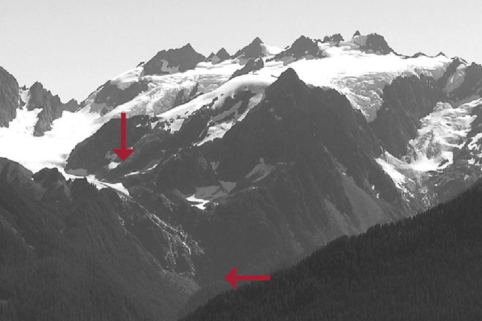
The photograph series assembled by Olympic National Park clearly shows the effects of a moderating climate on the volume of ice in the Olympic Mountains during the period 1899 to 2008. However, glacial recession has been ongoing since at least the early 1800s. By dating the regeneration of forests, geologists have determined that the Blue Glacier receded over 600m upslope between the years 1815 and 1900. During the maximum periods of glaciation during the period 1600 to 1815, the Blue and Hoh Glacier (on the left of the picture) actually merged in the valley in the foreground. 3
<Previous page Fur Trade Chapter Overview Next page>
Map and footnotes
- Sourced from the Olympic National Park website: http://www.nps.gov/olym/naturescience/glaciers.htm ↩
- Meany, E. S. Vancouver’s Discovery of the Puget Sound, Portraits and Biographies of the Men Honored in the Naming of Geographic Features of Northwestern America. MacMillan: New York, 1907 ↩
- Heusser, C.J., “Variations of Blue, Hoh and White Glaciers During Recent Centuries.” Arctic, 10(3), 139-150, 1957 ↩

