
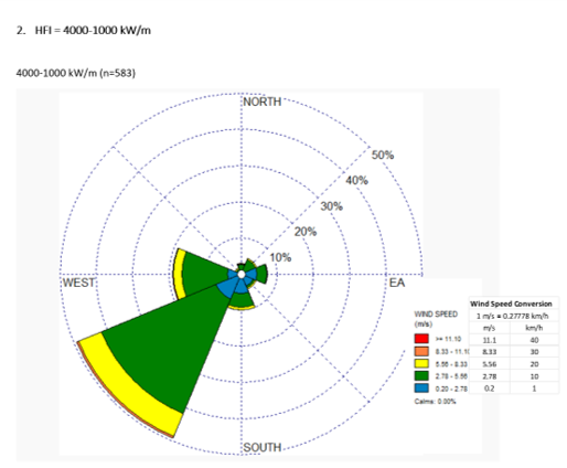
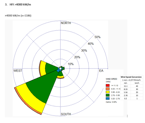
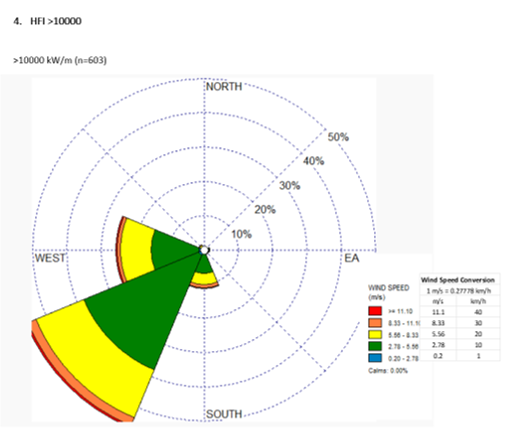
Windspeed and direction for number of days by various levels of predicted fire danger (headfire intensity ranges) from Banff Townsite weather station for the period 1961 to 2025. Click slider to look at intensity ranges (from Hirsch and Heathcott 2025).
This analysis clearly shows that the most extreme fire weather is driven by west and southwest winds. This makes sense when one considers the synoptic patterns that bring the hottest weather into the region. Here’s a recent example from July 18, 2026 when a weak frontal system passed over the Rockies. Kimberly was on evacuation notice that night from a wildfire threatening the ski area.
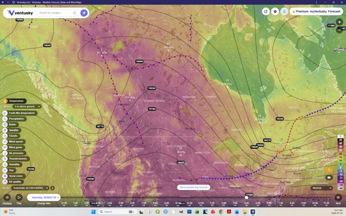
Synoptic 500 mb pattern, temperature, and wind speed/direction for July 18, 2026. Winds that afternoon were strong from the southwest and west in the Bow Valley. A fire threatened the Town of Kimberly,BC and the ski area that evening (Ventusky image). The town lies under the tightest gradient lines from a weak low pressure system pushing against high pressure drawing hot weather northwards from the the Columbia Plateau in Washington and Oregon. These states were also experience huge fires on this afternoon.
Return to Fire Weather Overview page